


A red flag warning has been issued for the Western Gabriel Mountains and along the Highway 14 corridor, due to gusty northeast winds expected to last through Tuesday evening. This caution part of an increased vigilance in the region to the ongoing wildfires threatening the area.
Initial Report and Immediate Response
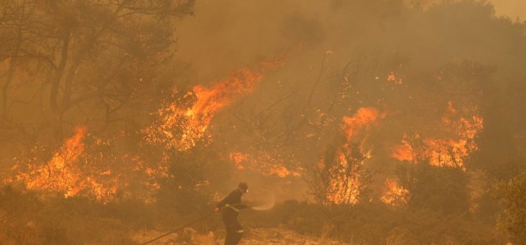
The fire of immediate concern was first reported at approximately 1:45 p.m. on Saturday, located at the intersection of Ralph’s Ranch and Gorman School roads near the 5 Freeway. In response to the swiftly spreading flames, the Los Angeles, California County Fire Department has implemented mandatory evacuation for 1,200 people from Hungry Valley Park and has closed Pyramid Lake to public access.
Evacuation Orders and Affected Regions
Specific areas under evacuation orders include:
- The regions west of Interstate 5 between Pyramid Lake and Gorman, notably involving the Hungry Valley State Vehicular Recreation Area.
- The Pyramid Lake Recreation Area, inclusive of attractions such as the South Dam Hiking Trail, Frenchman Flats, and the North Boater Parking Lot.
Tragically, the fires have already resulted in the destruction of one commercial property, and there has been a reported injury—a non-responder adult who sustained a lower extremity injury on Sunday.
Current Fire Statistics
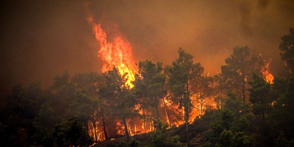
As of the latest reports, the fire has burned approximately 15,611 acres and is currently 24% contained. Fortunately, there have been no deaths reported, though the physical and material damages remain significant.
Hesperia Fire Update
Further east, the Hesperia Fire in San Bernardino County now covers 1,078 acres but shows more hopeful signs of containment at 72%. Efforts continue as fire crews focus on strengthening control lines and extinguishing hotspots.
Precautionary Measures and Transportation Impacts
Residents in close proximity to the Hesperia Fire, particularly those in Arrowhead Equestrian Estates, have been given an evacuation warning to stay vigilant and prepare to evacuate at short notice. Road travel has been affected by the closure of State Route 173 from the SR 138 junction to Lake Arrowhead Road.
Essential Resources and Information Channels
Residents seeking up-to-date information on the wildfires are encouraged to follow the Santa Clarita Valley Sheriff Station, L.A. County Fire Department, CAL FIRE, San Bernardino County Sheriff, and CAL FIRE San Bernardino Unit on their respective websites and social media platforms.
Air Quality Alerts
Given the widespread fires, the Air Quality Management District (AQMD) has warned of poor air quality conditions affecting Los Angeles, Southern Ventura County, and Riverside. Recommendations include staying indoors, minimizing exposure to outdoor air, and using air purifiers or air conditioners to mitigate the effects of smoke inhalation.
Ongoing Monitoring and Community Support
The situation remains dynamic, and local emergency services are tirelessly working to manage the fires and ensure public safety. Community members are urged to stay informed, adhere to safety guidelines, and support evacuation efforts where necessary.